Papplewick Grange, NG15
Introduction
The photograph on this page of Papplewick Grange, NG15 by David Hallam-Jones as part of the Geograph project.
The Geograph project started in 2005 with the aim of publishing, organising and preserving representative images for every square kilometre of Great Britain, Ireland and the Isle of Man.

There are currently over 7.5m images from over 14,400 individuals and you can help contribute to the project by visiting https://www.geograph.org.uk
Papplewick Grange, NG15
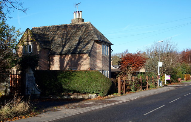
Image: © David Hallam-Jones Taken: 17 Nov 2012
Although large in size this appears to be the former lodge house at the entrance to the former Papplewick Grange. This private road, albeit a track, is a left hand turning off Moor Road, (the B683) seen here heading towards Papplewick. Behind a boundary hedge to the photographer's right are fields currently in use for arable purposes. This rectangular area, near the boundary with the Griffin's Head pub area and Forest Road (the B6011), is referred to on some maps as Papplewick Moor and it appears that it hosted the Royal Flying Corps Papplewick Moor Station and RAF Papplewick Moor Station between October 1916 - November 1945.
Images are licensed for reuse under creativecommons.org/licenses/by-sa/2.0
Image Location
Latitude
53.045891
Longitude
-1.181797