Site of Alloa station, 1991
Introduction
The photograph on this page of Site of Alloa station, 1991 by Ben Brooksbank as part of the Geograph project.
The Geograph project started in 2005 with the aim of publishing, organising and preserving representative images for every square kilometre of Great Britain, Ireland and the Isle of Man.

There are currently over 7.5m images from over 14,400 individuals and you can help contribute to the project by visiting https://www.geograph.org.uk
Site of Alloa station, 1991
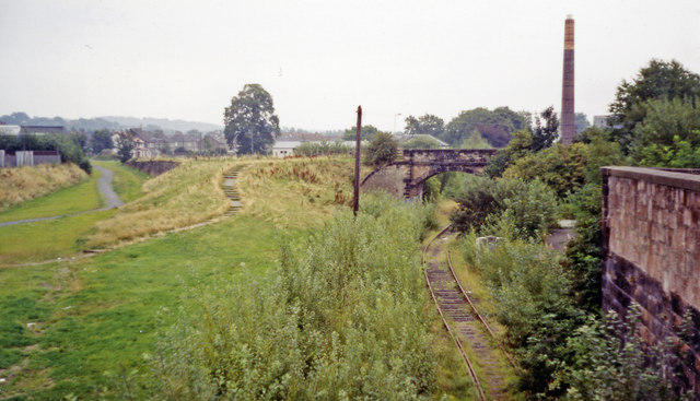
Image: © Ben Brooksbank Taken: 5 Sep 1991
View eastward, towards Kinross Junction, Thornton Junction via Oakley and Dunfermline Upper also via Culross and Dunfermline Lower, these being ex-NBR routes from Stirling, also ex-Caledonian services came from Larbert. This important junction station was closed on 7/10/68 - for goods not until 13/7/74, but happily this scene of desolation has passed, for a substantial new station was opened on 19/5/08, with a passenger service from Glasgow via Stirling over a line still kept open for coal traffic to Longannet Power Station on the Kincardine line - the half-rusted track seen here on the right. (See Image] by A.M. Jervis). Alloa station had lost its passenger services gradually: Dunfermline via Culross 7/7/30, Kinross Junction 15/6/64, Larbert 29/1/68, Stirling - Alloa - Oakley - Dunfermline 7/10/68.
Images are licensed for reuse under creativecommons.org/licenses/by-sa/2.0
Image Location
Latitude
56.11707
Longitude
-3.793078