Hillside path above Mamhilad
Introduction
The photograph on this page of Hillside path above Mamhilad by Jeremy Bolwell as part of the Geograph project.
The Geograph project started in 2005 with the aim of publishing, organising and preserving representative images for every square kilometre of Great Britain, Ireland and the Isle of Man.

There are currently over 7.5m images from over 14,400 individuals and you can help contribute to the project by visiting https://www.geograph.org.uk
Hillside path above Mamhilad
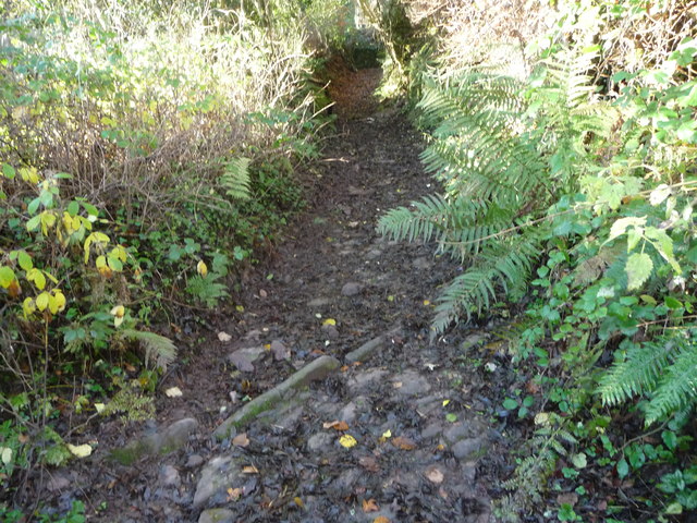
Image: © Jeremy Bolwell Taken: 18 Nov 2012
Surfaced with densely packed stone hewed from the underlying bedrock. It has suffered some damage from motorbike scramblers and water in heavy rains but incorporates gullies and gutters to carry run-off away from the surfaced path. It has been put forward as a medieval packhorse route but also a Roman road. Apparently a Roman coin was found at Troed-y-rhiw Farm nearby.
Images are licensed for reuse under creativecommons.org/licenses/by-sa/2.0
Image Location
Latitude
51.720217
Longitude
-3.019367