Drowned drumlins, Strangford Lough
Introduction
The photograph on this page of Drowned drumlins, Strangford Lough by Albert Bridge as part of the Geograph project.
The Geograph project started in 2005 with the aim of publishing, organising and preserving representative images for every square kilometre of Great Britain, Ireland and the Isle of Man.

There are currently over 7.5m images from over 14,400 individuals and you can help contribute to the project by visiting https://www.geograph.org.uk
Drowned drumlins, Strangford Lough
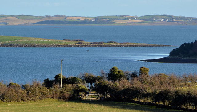
Image: © Albert Bridge Taken: 16 Nov 2012
Many of the islands in Strangford Lough are drowned drumlins. This view is across the lough, at 2hrs 20mins after low water Killyleagh, from a height of about 100ft, on the Ballymorran Road, to the east of Killinchy. The land in the foreground is below the road. Part of Trasnagh Island cuts across the middle. The partly-wooded Conly Island (also seen in the background, from a lower and more southerly viewpoint, in Image - December 2006) is at middle right. The western side of the Ards Peninsula is at the top, on the other side of Strangford Lough.
Images are licensed for reuse under creativecommons.org/licenses/by-sa/2.0
Image Location
Latitude
54.47555
Longitude
-5.644312