Part of the Link Centre, Swindon
Introduction
The photograph on this page of Part of the Link Centre, Swindon by Jeremy Bolwell as part of the Geograph project.
The Geograph project started in 2005 with the aim of publishing, organising and preserving representative images for every square kilometre of Great Britain, Ireland and the Isle of Man.

There are currently over 7.5m images from over 14,400 individuals and you can help contribute to the project by visiting https://www.geograph.org.uk
Part of the Link Centre, Swindon
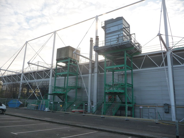
Image: © Jeremy Bolwell Taken: 6 Nov 2012
As Swindon expanded rapidly in the 1970's and 1980's this was the sort of building that the town wanted; a big architectural statement, no doubt nominated and maybe even winning design awards and plaudits but it has, I understand, been plagued with some of the issues that Councils dread - Legionella in the water supply system, floods, electrical failures related to floods and an on-going maintenance and building expenses bill far beyond what anyone envisaged when beaming at architects plans in halcyon days long ago. Plus, to a visitor at least, it isn't immediately obvious where the entrance door is. I virtually circumnavigated it before finding it. It's a leisure centre (housing 'the biggest indoor climbing-wall in Wiltshire'), ice rink (home to Swindon Wildcats ice hockey team), library (scarlet carpet tiles!) and community centre. Yes, it does look like a waste incinerating facility, dockside warehouse or a bus depot maybe.
Images are licensed for reuse under creativecommons.org/licenses/by-sa/2.0
Image Location
Latitude
51.559081
Longitude
-1.83147