Churches, St Marychurch
Introduction
The photograph on this page of Churches, St Marychurch by Derek Harper as part of the Geograph project.
The Geograph project started in 2005 with the aim of publishing, organising and preserving representative images for every square kilometre of Great Britain, Ireland and the Isle of Man.

There are currently over 7.5m images from over 14,400 individuals and you can help contribute to the project by visiting https://www.geograph.org.uk
Churches, St Marychurch
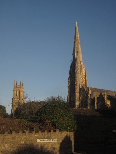
Image: © Derek Harper Taken: 7 Nov 2012
In this view from the junction of Priory Road and St Margaret's Road, the spire of Our Lady, Help of Christians and St Denis Image dominates the tower of St Mary's Church Image
Images are licensed for reuse under creativecommons.org/licenses/by-sa/2.0
Image Location
Latitude
50.482643
Longitude
-3.525017