Thorndon House, Rewe
Introduction
The photograph on this page of Thorndon House, Rewe by Derek Harper as part of the Geograph project.
The Geograph project started in 2005 with the aim of publishing, organising and preserving representative images for every square kilometre of Great Britain, Ireland and the Isle of Man.

There are currently over 7.5m images from over 14,400 individuals and you can help contribute to the project by visiting https://www.geograph.org.uk
Thorndon House, Rewe
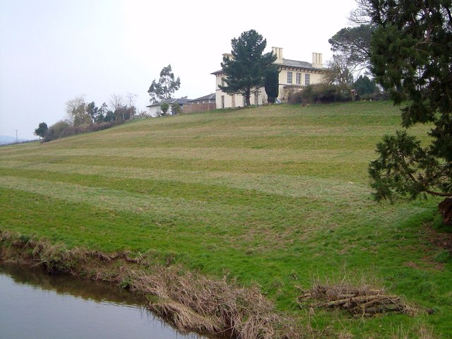
Image: © Derek Harper Taken: 23 Mar 2006
In an impressive spot overlooking the River Culm, this was formerly the rectory, built in 1840 by Brunel. The reason for this is that construction of the Bristol and Exeter Railway, which runs through the hamlet, required the demolition of the existing rectory http://list.english-heritage.org.uk/resultsingle.aspx?uid=1333261&searchtype=mapsearch . I suspect this resulted in a better view! This is taken from the footbridge carrying Rewe Footpath 1 over the river.
Images are licensed for reuse under creativecommons.org/licenses/by-sa/2.0
Image Location
Latitude
50.781764
Longitude
-3.49728