Aqueduct and viaduct over Goyt valley, 1961
Introduction
The photograph on this page of Aqueduct and viaduct over Goyt valley, 1961 by Robin Webster as part of the Geograph project.
The Geograph project started in 2005 with the aim of publishing, organising and preserving representative images for every square kilometre of Great Britain, Ireland and the Isle of Man.

There are currently over 7.5m images from over 14,400 individuals and you can help contribute to the project by visiting https://www.geograph.org.uk
Aqueduct and viaduct over Goyt valley, 1961
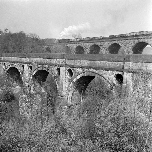
Image: © Robin Webster Taken: 11 Apr 1961
The Peak Forest Canal was more or less disused at this time, but the railway was thriving. A 4F 0-6-0 heads towards Manchester with a freight train. The aqueduct first took water in 1800 and suffered very serious frost damage during the winter after this photograph. It was listed as a grade I building in 1966 and was restored after the cost of demolition was estimated to exceed the cost of restoration.
Images are licensed for reuse under creativecommons.org/licenses/by-sa/2.0
Image Location
Latitude
53.407965
Longitude
-2.069758