Church of Saint Maugan
Introduction
The photograph on this page of Church of Saint Maugan by Stuart Logan as part of the Geograph project.
The Geograph project started in 2005 with the aim of publishing, organising and preserving representative images for every square kilometre of Great Britain, Ireland and the Isle of Man.

There are currently over 7.5m images from over 14,400 individuals and you can help contribute to the project by visiting https://www.geograph.org.uk
Church of Saint Maugan
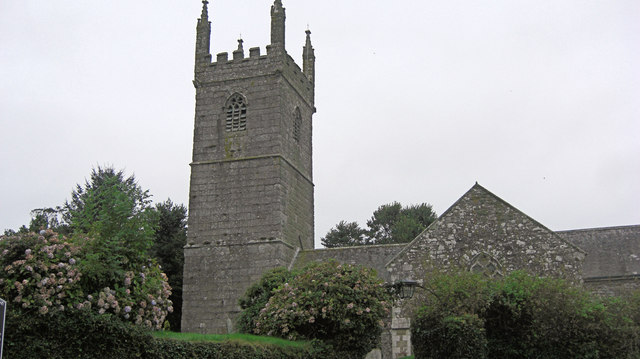
Image: © Stuart Logan Taken: 11 Oct 2012
English Heritage have listed this church Grade I and given it English Heritage Building ID: 65309. It is their spelling in the title. The building dates from the 13th C but was remodelled in the 15th C. The tower is typical of 15th C Cornish west towers and is a very complete example. For more detail see: http://www.britishlistedbuildings.co.uk/en-65309-church-of-saint-maugan-mawgan-in-meneage-
Images are licensed for reuse under creativecommons.org/licenses/by-sa/2.0
Image Location
Latitude
50.081682
Longitude
-5.202999