Former Congregational Church, Catrine
Introduction
The photograph on this page of Former Congregational Church, Catrine by Leslie Barrie as part of the Geograph project.
The Geograph project started in 2005 with the aim of publishing, organising and preserving representative images for every square kilometre of Great Britain, Ireland and the Isle of Man.

There are currently over 7.5m images from over 14,400 individuals and you can help contribute to the project by visiting https://www.geograph.org.uk
Former Congregational Church, Catrine
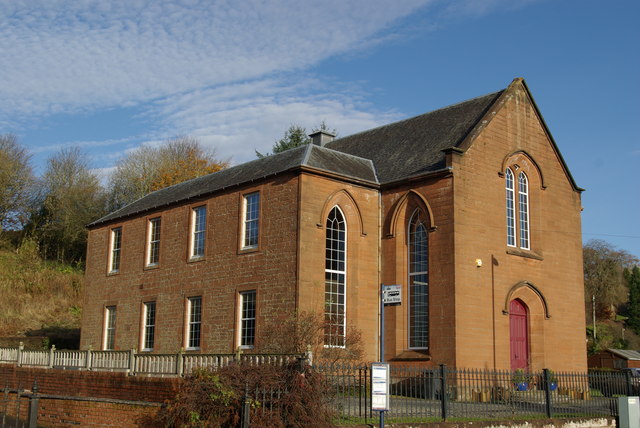
Image: © Leslie Barrie Taken: 5 Nov 2012
Built in 1845 as the Free Church, it later became the Congregational Church in 1960. Since closing for worship in 2002 it has now become a private dwelling.
Images are licensed for reuse under creativecommons.org/licenses/by-sa/2.0
Image Location
Latitude
55.505544
Longitude
-4.336043