Firhill Basin
Introduction
The photograph on this page of Firhill Basin by Lairich Rig as part of the Geograph project.
The Geograph project started in 2005 with the aim of publishing, organising and preserving representative images for every square kilometre of Great Britain, Ireland and the Isle of Man.

There are currently over 7.5m images from over 14,400 individuals and you can help contribute to the project by visiting https://www.geograph.org.uk
Firhill Basin
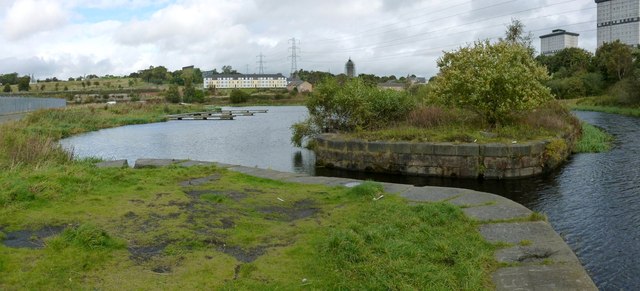
Image: © Lairich Rig Taken: 1 Oct 2012
Just right of centre is one end of a curving barrier that separates Firhill Basin (on the left) from the main body of the Glasgow Branch of the Forth and Clyde Canal (on the right). The high flats on the right are on Wester Common Road. Just right of centre in the background, and surrounded by scaffolding, is the water tower of the closed Ruchill Hospital: Image
Images are licensed for reuse under creativecommons.org/licenses/by-sa/2.0
Image Location
Latitude
55.881893
Longitude
-4.267307