Sheffield, S1 - Canal Basin
Introduction
The photograph on this page of Sheffield, S1 - Canal Basin by David Hallam-Jones as part of the Geograph project.
The Geograph project started in 2005 with the aim of publishing, organising and preserving representative images for every square kilometre of Great Britain, Ireland and the Isle of Man.

There are currently over 7.5m images from over 14,400 individuals and you can help contribute to the project by visiting https://www.geograph.org.uk
Sheffield, S1 - Canal Basin
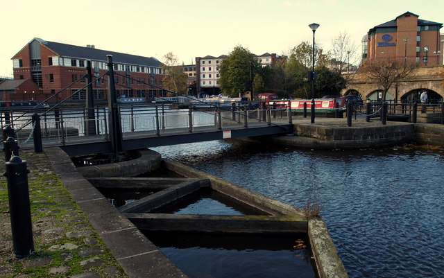
Image: © David Hallam-Jones Taken: 27 Oct 2012
This swing bridge allows access into the terminal part of the Sheffield and Tinsley canal basin. As is evident, it has now become a leisure and business centre with offices, cafes and hotels predominating. The canal and its basin was constructed between 1816-19 but ceased to function as a cargo port in 1970. Following the termination of commercial operations the site and buildings were neglected until the Victoria Quays restoration and redevelopment project of 1992-94.
Images are licensed for reuse under creativecommons.org/licenses/by-sa/2.0
Image Location
Latitude
53.385092
Longitude
-1.457514