Eaglais Shaor Chleireach na h-Alba/Free Presbyterian Church of Scotland
Introduction
The photograph on this page of Eaglais Shaor Chleireach na h-Alba/Free Presbyterian Church of Scotland by Tiger as part of the Geograph project.
The Geograph project started in 2005 with the aim of publishing, organising and preserving representative images for every square kilometre of Great Britain, Ireland and the Isle of Man.

There are currently over 7.5m images from over 14,400 individuals and you can help contribute to the project by visiting https://www.geograph.org.uk
Eaglais Shaor Chleireach na h-Alba/Free Presbyterian Church of Scotland
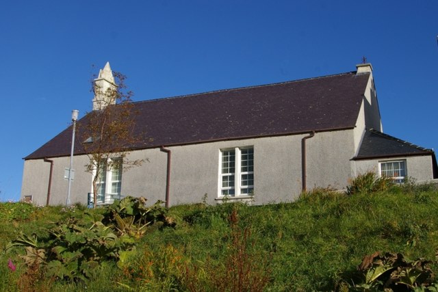
Image: © Tiger Taken: 19 Oct 2012
Looking over the harbour and East Loch Tarbert, this is the FP church for the parish of North Harris, built around 1900 and summarised by John Gifford as a harled box with pinnacled bellcote.
Images are licensed for reuse under creativecommons.org/licenses/by-sa/2.0
Image Location
Latitude
57.898155
Longitude
-6.797407