Road marked up to show all buried utilities in Campion Way
Introduction
The photograph on this page of Road marked up to show all buried utilities in Campion Way by Peter Facey as part of the Geograph project.
The Geograph project started in 2005 with the aim of publishing, organising and preserving representative images for every square kilometre of Great Britain, Ireland and the Isle of Man.

There are currently over 7.5m images from over 14,400 individuals and you can help contribute to the project by visiting https://www.geograph.org.uk
Road marked up to show all buried utilities in Campion Way
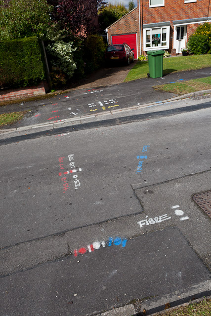
Image: © Peter Facey Taken: 27 Sep 2012
Yellow - gas, blue - water, red - electricity, white - telephone, cable TV, fibre optics. Depths are also shown where this can be measured, which is not the case with fibre optics unless an electrical tracing wire has been laid together with the fibre.
Images are licensed for reuse under creativecommons.org/licenses/by-sa/2.0
Image Location
Latitude
51.09439
Longitude
-1.299524