Milestone on south side of A35
Introduction
The photograph on this page of Milestone on south side of A35 by Roger Templeman as part of the Geograph project.
The Geograph project started in 2005 with the aim of publishing, organising and preserving representative images for every square kilometre of Great Britain, Ireland and the Isle of Man.

There are currently over 7.5m images from over 14,400 individuals and you can help contribute to the project by visiting https://www.geograph.org.uk
Milestone on south side of A35
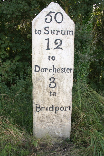
Image: © Roger Templeman Taken: 19 Sep 2012
There was an Ordnance Survey cut mark benchmark between 'Bridport' and the ground which has been chiselled off. The mark is described on the Bench Mark Database at http://www.bench-marks.org.uk/bm28991
Images are licensed for reuse under creativecommons.org/licenses/by-sa/2.0
Image Location
Latitude
50.733064
Longitude
-2.701206