River Stour, Shipston on Stour
Introduction
The photograph on this page of River Stour, Shipston on Stour by Stephen McKay as part of the Geograph project.
The Geograph project started in 2005 with the aim of publishing, organising and preserving representative images for every square kilometre of Great Britain, Ireland and the Isle of Man.

There are currently over 7.5m images from over 14,400 individuals and you can help contribute to the project by visiting https://www.geograph.org.uk
River Stour, Shipston on Stour
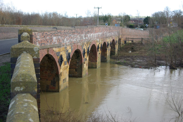
Image: © Stephen McKay Taken: 21 Jan 2007
The name Shipston is a derivation of Sheepwashtown, a saxon settlement by a ford that was used as a sheep wash. There is no ford here now, but this old bridge carries the B4035 to Banbury over the river.
Images are licensed for reuse under creativecommons.org/licenses/by-sa/2.0
Image Location


Leaflet Map data © OpenStreetMap
Latitude
52.061551
Longitude
-1.621881