St Andrew's suspension bridge
Introduction
The photograph on this page of St Andrew's suspension bridge by Thomas Nugent as part of the Geograph project.
The Geograph project started in 2005 with the aim of publishing, organising and preserving representative images for every square kilometre of Great Britain, Ireland and the Isle of Man.

There are currently over 7.5m images from over 14,400 individuals and you can help contribute to the project by visiting https://www.geograph.org.uk
St Andrew's suspension bridge
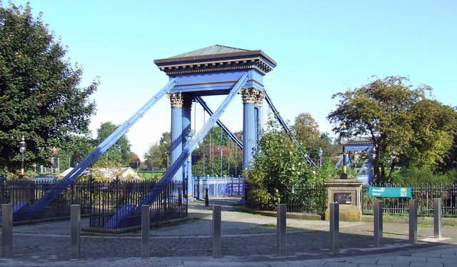
Image: © Thomas Nugent Taken: 8 Oct 2012
The south side of the bridge which links The Gorbals and Glasgow Green on opposite banks of the Clyde. A nearby plaque states that the bridge opened in 1855 to replace a busy ferry.
Images are licensed for reuse under creativecommons.org/licenses/by-sa/2.0
Image Location
Latitude
55.848442
Longitude
-4.238839