Blackwood Miner's Welfare Institute
Introduction
The photograph on this page of Blackwood Miner's Welfare Institute by Jeremy Bolwell as part of the Geograph project.
The Geograph project started in 2005 with the aim of publishing, organising and preserving representative images for every square kilometre of Great Britain, Ireland and the Isle of Man.

There are currently over 7.5m images from over 14,400 individuals and you can help contribute to the project by visiting https://www.geograph.org.uk
Blackwood Miner's Welfare Institute
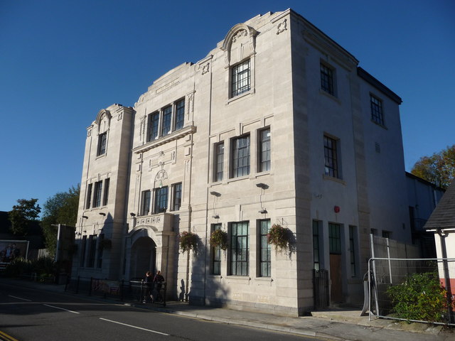
Image: © Jeremy Bolwell Taken: 14 Oct 2012
Known as Blackwood Miners' Institute. Funded by threepence deductions from local miner's weekly wagepackets and is dated 1925 - the year prior to the General Strike. In its early heyday it offered dances, snooker and billiards tables, reading rooms, library, rehearsal rooms and meeting rooms for local clubs, groups and societies, a ladies room, stage and auditorium and a focal point for the town. It fell into disrepair and decay in the 1970's and 1980's and was taken over by the local council who regenerated it and today it enjoys a second heyday. Here two lady joggers run by on a sunny autumn Sunday morning.
Images are licensed for reuse under creativecommons.org/licenses/by-sa/2.0
Image Location
Latitude
51.670812
Longitude
-3.195403