Melville Methodist Church, near Farlow
Introduction
The photograph on this page of Melville Methodist Church, near Farlow by P L Chadwick as part of the Geograph project.
The Geograph project started in 2005 with the aim of publishing, organising and preserving representative images for every square kilometre of Great Britain, Ireland and the Isle of Man.

There are currently over 7.5m images from over 14,400 individuals and you can help contribute to the project by visiting https://www.geograph.org.uk
Melville Methodist Church, near Farlow
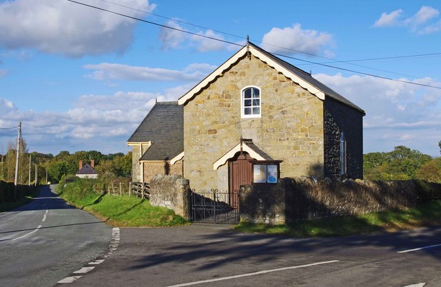
Image: © P L Chadwick Taken: 14 Oct 2012
This is an unusual survivor, a Methodist church or chapel in a very rural area and still in use, serving a scattered rural community in south Shropshire. It was originally built for the Wesleyans as a wayside chapel and is dated 1833. Since the 1st September 2010, it has been part of the Shropshire & Marches Methodist Circuit. It is a listed building. Image
Images are licensed for reuse under creativecommons.org/licenses/by-sa/2.0
Image Location
Latitude
52.414394
Longitude
-2.526298