No 7 Lower Crescent, Belfast (1)
Introduction
The photograph on this page of No 7 Lower Crescent, Belfast (1) by Albert Bridge as part of the Geograph project.
The Geograph project started in 2005 with the aim of publishing, organising and preserving representative images for every square kilometre of Great Britain, Ireland and the Isle of Man.

There are currently over 7.5m images from over 14,400 individuals and you can help contribute to the project by visiting https://www.geograph.org.uk
No 7 Lower Crescent, Belfast (1)
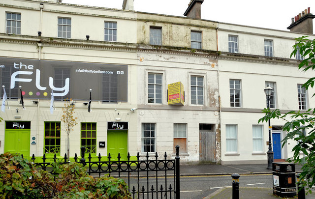
Image: © Albert Bridge Taken: 14 Oct 2012
No 7 Lower Crescent is currently advertised “for sale”. The agents’ description includes the following: “The subject property benefits from full planning permission (granted 11 September 2008) to convert the existing accommodation to a licensed premises, to include demolition of the rear return and rebuild with the retention of the existing facade onto Lower Crescent (Application No. /2007/2076/F)”. The building, which seems to be in a poor state of repair, is listed http://www.doeni.gov.uk/niea/built/buildview?id=2593&js=true. The list comments “Relatively large three storey rendered town house, one of regency style terrace of eleven similar, (but not identical) properties built in 1852 and now converted to offices, flats and a public house”. This photograph appears as a matter of record only. I have no connection with any of the parties involved in the sale and express no views about the approval to demolish. See also Image
Images are licensed for reuse under creativecommons.org/licenses/by-sa/2.0
Image Location
Latitude
54.587869
Longitude
-5.934266