Cherry Tree Road and Church Path, Rainham, Kent
Introduction
The photograph on this page of Cherry Tree Road and Church Path, Rainham, Kent by Craig as part of the Geograph project.
The Geograph project started in 2005 with the aim of publishing, organising and preserving representative images for every square kilometre of Great Britain, Ireland and the Isle of Man.

There are currently over 7.5m images from over 14,400 individuals and you can help contribute to the project by visiting https://www.geograph.org.uk
Cherry Tree Road and Church Path, Rainham, Kent
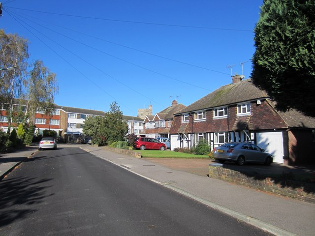
Image: © Craig Taken: 14 Oct 2012
Rainham south of Watling Street was built up between 1960 and the 1980's. Many of the houses were built by Wards, a local firm. Some of their designs tried to make the houses look bigger. A pair of semi's might be designed to look like one larger detached house by putting one front door on the front wall and one in the side wall. Many front lawns were turfed without a dividing fence. The older houses in this picture were built for £2600-£2850 in 1961. St. Margarets Church is in the background of this picture.
Images are licensed for reuse under creativecommons.org/licenses/by-sa/2.0
Image Location
Latitude
51.361304
Longitude
0.608495