Donkey wellhouse, Wellhouse Road
Introduction
The photograph on this page of Donkey wellhouse, Wellhouse Road by Hugh Craddock as part of the Geograph project.
The Geograph project started in 2005 with the aim of publishing, organising and preserving representative images for every square kilometre of Great Britain, Ireland and the Isle of Man.

There are currently over 7.5m images from over 14,400 individuals and you can help contribute to the project by visiting https://www.geograph.org.uk
Donkey wellhouse, Wellhouse Road
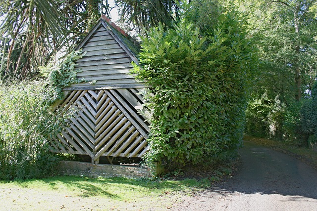
Image: © Hugh Craddock Taken: 13 Oct 2012
This small square wooden building with a slate roof is not a garage, but a grade II listed donkey wellhouse, situated at Beech Barns, towards the end of Wellhouse Road, and dating perhaps from the late C18. A donkey wheel and winch can be seen within, through the slatted panel, together with a cover over the well shaft. The well is reported to be 60m deep.
Images are licensed for reuse under creativecommons.org/licenses/by-sa/2.0
Image Location
Latitude
51.141923
Longitude
-1.019199