Grand Union Canal: Bridge Number 37A: St Mary's Road Bridge
Introduction
The photograph on this page of Grand Union Canal: Bridge Number 37A: St Mary's Road Bridge by Nigel Cox as part of the Geograph project.
The Geograph project started in 2005 with the aim of publishing, organising and preserving representative images for every square kilometre of Great Britain, Ireland and the Isle of Man.

There are currently over 7.5m images from over 14,400 individuals and you can help contribute to the project by visiting https://www.geograph.org.uk
Grand Union Canal: Bridge Number 37A: St Mary's Road Bridge
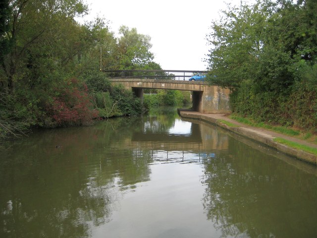
Image: © Nigel Cox Taken: 5 Sep 2012
As the number suggests this is a modern bridge built between the original crossings at Numbers 37 and 38. Old Ordnance Survey maps show that St Mary's Road, past the eponymous church and to the north of the canal, was already built by 1889, but it was not until the 1971 map was produced that the bridge is shown as built with the road extended southwards to a new industrial estate.
Images are licensed for reuse under creativecommons.org/licenses/by-sa/2.0
Image Location
Latitude
52.282266
Longitude
-1.522088