Edge Hill
Introduction
The photograph on this page of Edge Hill by Nigel Mykura as part of the Geograph project.
The Geograph project started in 2005 with the aim of publishing, organising and preserving representative images for every square kilometre of Great Britain, Ireland and the Isle of Man.

There are currently over 7.5m images from over 14,400 individuals and you can help contribute to the project by visiting https://www.geograph.org.uk
Edge Hill
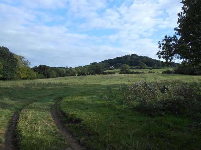
Image: © Nigel Mykura Taken: 14 Sep 2012
This shows the northern end of the Edgehill escarpment at Knowle End which is the prominent wooded hill. The trees to the immediate left of the white house mark the line of the Edgehill Light Railway (EHLR) which ran up to the top of the hill via a rope powered 1 in 6 incline at that point. The railway was built to remove ironstone from quarries on the hill top but the project was a financial failure. The operation probably worked properly for only a few months (if at all) in the summer of 1922. In October of that year there was a fatal accident on the worked incline and the line was never repaired. Part of the lower section of the line was taken over by the MOD during the war. Most of the lower section of the line has been obliterated by Kineton munitions depot and the line of the railway can only clearly be seen in this area. Most of the track that remained and its locos and equipment were scrapped immediately after World War two and the company was wound up in 1957.
Images are licensed for reuse under creativecommons.org/licenses/by-sa/2.0
Image Location
Latitude
52.137894
Longitude
-1.443418