Boharm Parish Kirk
Introduction
The photograph on this page of Boharm Parish Kirk by Anne Burgess as part of the Geograph project.
The Geograph project started in 2005 with the aim of publishing, organising and preserving representative images for every square kilometre of Great Britain, Ireland and the Isle of Man.

There are currently over 7.5m images from over 14,400 individuals and you can help contribute to the project by visiting https://www.geograph.org.uk
Boharm Parish Kirk
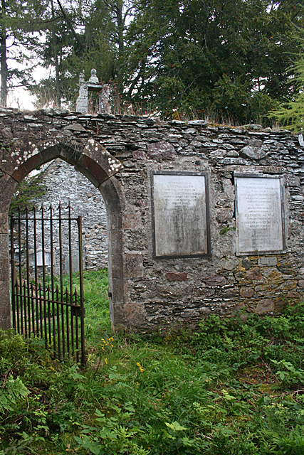
Image: © Anne Burgess Taken: 8 Oct 2012
Looking out of the right-hand doorway in Image] into what was presumably the main part of the kirk. These plaques commemorate members of the MacDowall Grant family of Arndilly, at one time probably the owners of the largest proportion of the parish.
Images are licensed for reuse under creativecommons.org/licenses/by-sa/2.0
Image Location
Latitude
57.503053
Longitude
-3.134385