High Street
Introduction
The photograph on this page of High Street by Ian Capper as part of the Geograph project.
The Geograph project started in 2005 with the aim of publishing, organising and preserving representative images for every square kilometre of Great Britain, Ireland and the Isle of Man.

There are currently over 7.5m images from over 14,400 individuals and you can help contribute to the project by visiting https://www.geograph.org.uk
High Street
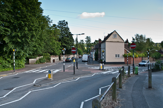
Image: © Ian Capper Taken: 19 Jun 2012
Seen here at its junction with Needles Bank (on the right). On the left, just after the zebra crossing, is a footpath to Court Road (see Image). The hearthstone wall beyond is reputed to date from the 15th century but considered by some to be more likely to be 17th/18th century. It features galleting in many of the mortar joints (see Image for close up of a similar wall slightly further south along High Street) and is grade II listed - see www.historicengland.org.uk/listing/the-list/list-entry/1188622.
Images are licensed for reuse under creativecommons.org/licenses/by-sa/2.0
Image Location
Latitude
51.249066
Longitude
-0.066976