Former Level Crossing, Station Road
Introduction
The photograph on this page of Former Level Crossing, Station Road by Paul Franks as part of the Geograph project.
The Geograph project started in 2005 with the aim of publishing, organising and preserving representative images for every square kilometre of Great Britain, Ireland and the Isle of Man.

There are currently over 7.5m images from over 14,400 individuals and you can help contribute to the project by visiting https://www.geograph.org.uk
Former Level Crossing, Station Road
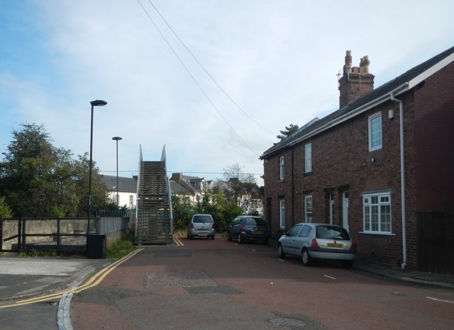
Image: © Paul Franks Taken: 23 Sep 2012
The bushes mark the site of the level crossing, which was closed after the opening of Forest Hall Bridge in 1964. The footbridge crosses the East Coast main railway line, and links Station Road with Station Road North, beyond. The houses on the right are 80-84 Station Road, which were built for railway employees. There were originally four houses, but No. 86 was demolished.
Images are licensed for reuse under creativecommons.org/licenses/by-sa/2.0
Image Location


Leaflet Map data © OpenStreetMap
Latitude
55.021073
Longitude
-1.567667