The Orange Way in Wiltshire (64)
Introduction
The photograph on this page of The Orange Way in Wiltshire (64) by Shazz as part of the Geograph project.
The Geograph project started in 2005 with the aim of publishing, organising and preserving representative images for every square kilometre of Great Britain, Ireland and the Isle of Man.

There are currently over 7.5m images from over 14,400 individuals and you can help contribute to the project by visiting https://www.geograph.org.uk
The Orange Way in Wiltshire (64)
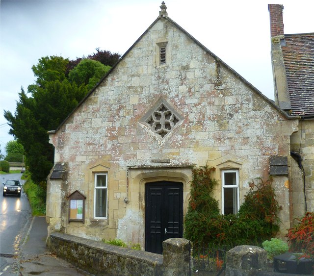
Image: © Shazz Taken: 26 Sep 2012
This is the Village Hall in Hindon. The car is coming down Stops Hill. It's still raining. It is here that the Orange and Monarch's Ways meet up again. To proceed to the next section of the Orange Way go to www.geograph.org.uk/geotrips/440.
Images are licensed for reuse under creativecommons.org/licenses/by-sa/2.0
Image Location
Latitude
51.093271
Longitude
-2.126465