Powick Mills
Introduction
The photograph on this page of Powick Mills by Chris Allen as part of the Geograph project.
The Geograph project started in 2005 with the aim of publishing, organising and preserving representative images for every square kilometre of Great Britain, Ireland and the Isle of Man.

There are currently over 7.5m images from over 14,400 individuals and you can help contribute to the project by visiting https://www.geograph.org.uk
Powick Mills
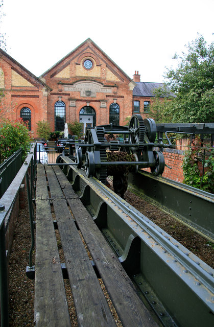
Image: © Chris Allen Taken: 30 Sep 2012
This is a site long associated with water power but the building in the background is Worcester's first electric power station and the gable wall is dated 1894. It was a combined hydroelectric and reciprocating steam engine plant and was superseded in the 1920s. It is now housing. The hand worked travelling crane in the foreground formerly spanned one of the plant rooms.
Images are licensed for reuse under creativecommons.org/licenses/by-sa/2.0
Image Location
Latitude
52.171053
Longitude
-2.24224