Gernon Bushes information board
Introduction
The photograph on this page of Gernon Bushes information board by Roger Jones as part of the Geograph project.
The Geograph project started in 2005 with the aim of publishing, organising and preserving representative images for every square kilometre of Great Britain, Ireland and the Isle of Man.

There are currently over 7.5m images from over 14,400 individuals and you can help contribute to the project by visiting https://www.geograph.org.uk
Gernon Bushes information board
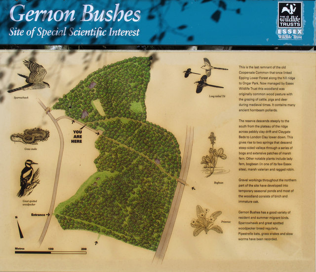
Image: © Roger Jones Taken: 29 Sep 2012
As seen at the entrance from Garnon Mead.
Images are licensed for reuse under creativecommons.org/licenses/by-sa/2.0
Image Location
Latitude
51.706544
Longitude
0.137771