The M2 hill section, Bellevue, Newtownabbey
Introduction
The photograph on this page of The M2 hill section, Bellevue, Newtownabbey by Albert Bridge as part of the Geograph project.
The Geograph project started in 2005 with the aim of publishing, organising and preserving representative images for every square kilometre of Great Britain, Ireland and the Isle of Man.

There are currently over 7.5m images from over 14,400 individuals and you can help contribute to the project by visiting https://www.geograph.org.uk
The M2 hill section, Bellevue, Newtownabbey
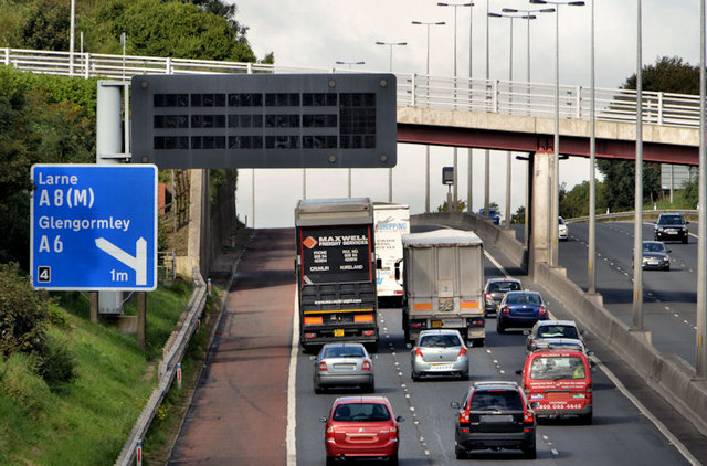
Image: © Albert Bridge Taken: 28 Sep 2012
See Image The outward view, from the Bellevue Bridge, towards Sandyknowes. The Collin Bridge (background) was rebuilt with a very high fence making photography there next to impossible. The Belfast/Newtownabbey boundary is immediately on the Belfast side of the Bellevue Bridge.
Images are licensed for reuse under creativecommons.org/licenses/by-sa/2.0
Image Location
Latitude
54.665159
Longitude
-5.951269