Incorrect distance shown on road sign, Abercrave
Introduction
The photograph on this page of Incorrect distance shown on road sign, Abercrave by Jaggery as part of the Geograph project.
The Geograph project started in 2005 with the aim of publishing, organising and preserving representative images for every square kilometre of Great Britain, Ireland and the Isle of Man.

There are currently over 7.5m images from over 14,400 individuals and you can help contribute to the project by visiting https://www.geograph.org.uk
Incorrect distance shown on road sign, Abercrave
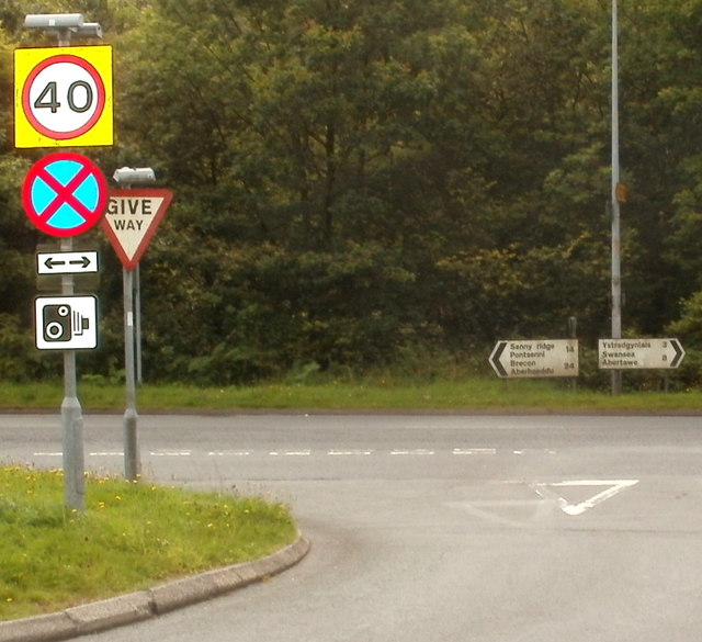
Image: © Jaggery Taken: 29 Aug 2011
The distance shown to Swansea is 8 miles, whereas the actual distance is nearer 16 miles. The A4067 to Swansea goes through Ystradgynlais, which is about 13 miles NE of central Swansea and 3 miles from this spot (as shown on the sign). Turn left for Sennybridge (14 miles) or Brecon (24 miles).
Images are licensed for reuse under creativecommons.org/licenses/by-sa/2.0
Image Location
Latitude
51.798897
Longitude
-3.720872