Army camp at Bowers Farm in 1928
Introduction
The photograph on this page of Army camp at Bowers Farm in 1928 by George Baker as part of the Geograph project.
The Geograph project started in 2005 with the aim of publishing, organising and preserving representative images for every square kilometre of Great Britain, Ireland and the Isle of Man.

There are currently over 7.5m images from over 14,400 individuals and you can help contribute to the project by visiting https://www.geograph.org.uk
Army camp at Bowers Farm in 1928
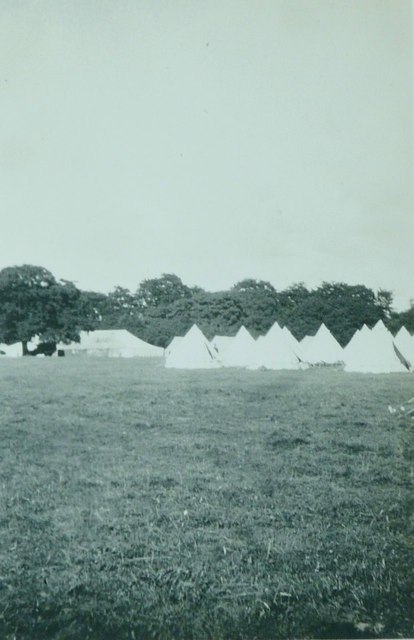
Image: © George Baker Taken: Unknown
Photographed by my father George Baker while he was staying in the camp. From an aerial perspective, it seems probable that the camp was based in a field to the northwest of the farm as it is, today, bounded by tall trees on its western boundary. My father was 17 at the time he took the photograph and attending Image which had a CCF (Combined Cadet Force) and would have organised a summer camp for boys who wished to attend, probably in August. His identification of the location mentions Mytchett OTC, which stands for Officers Training Corps, so I assume he had reached this rank. Bowers Farm would have been within easy reach of the school, bearing in mind that the roads would not have had the surfaces we are used to nowadays.
Images are licensed for reuse under creativecommons.org/licenses/by-sa/2.0
Image Location


Leaflet Map data © OpenStreetMap
Latitude
51.641426
Longitude
-0.624916