Lock and industrial buildings near Saltley, Birmingham
Introduction
The photograph on this page of Lock and industrial buildings near Saltley, Birmingham by Roger D Kidd as part of the Geograph project.
The Geograph project started in 2005 with the aim of publishing, organising and preserving representative images for every square kilometre of Great Britain, Ireland and the Isle of Man.

There are currently over 7.5m images from over 14,400 individuals and you can help contribute to the project by visiting https://www.geograph.org.uk
Lock and industrial buildings near Saltley, Birmingham
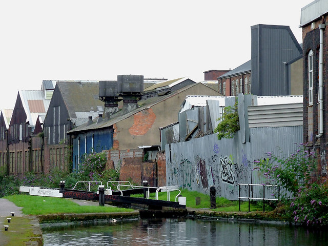
Image: © Roger D Kidd Taken: 21 Aug 2012
Grand Union Canal, looking north towards Salford Junction. This was formerly the Birmingham and Warwick Junction Canal, opened in 1844 to avoid the more heavily locked route through the city. Behind the unsightly galvanised corrugated iron fence and wall on the right by the lock is a car breaker's yard. Travelling south, the flight of five Garrison Locks allows a rise of 34ft 5in (10·3 metres). Lock No 62 is the second one up in the flight. Wikipedia describes how it was on this 2·5 mile link canal sometimes called the Saltley Cut: "... was reviled as the filthiest place on the whole canal system, with gas works, a power station, railway works and a chemical works all generating or receiving cargoes, and discharging waste into the canal ..."
Images are licensed for reuse under creativecommons.org/licenses/by-sa/2.0
Image Location
Latitude
52.48588
Longitude
-1.863092