Former RAF Manby and ELDC offices
Introduction
The photograph on this page of Former RAF Manby and ELDC offices by Chris as part of the Geograph project.
The Geograph project started in 2005 with the aim of publishing, organising and preserving representative images for every square kilometre of Great Britain, Ireland and the Isle of Man.

There are currently over 7.5m images from over 14,400 individuals and you can help contribute to the project by visiting https://www.geograph.org.uk
Former RAF Manby and ELDC offices
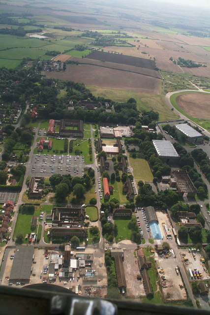
Image: © Chris Taken: 7 Sep 2012
The old air base, looking south towards Carlton. The burnt out hangar shown in Image is on the extreme right. East Lindsey District Council's offices are the building with the grassy quadrangle at the far end.
Images are licensed for reuse under creativecommons.org/licenses/by-sa/2.0
Image Location
Latitude
53.362463
Longitude
0.094721