No footway ahead, Locking
Introduction
The photograph on this page of No footway ahead, Locking by Jaggery as part of the Geograph project.
The Geograph project started in 2005 with the aim of publishing, organising and preserving representative images for every square kilometre of Great Britain, Ireland and the Isle of Man.

There are currently over 7.5m images from over 14,400 individuals and you can help contribute to the project by visiting https://www.geograph.org.uk
No footway ahead, Locking
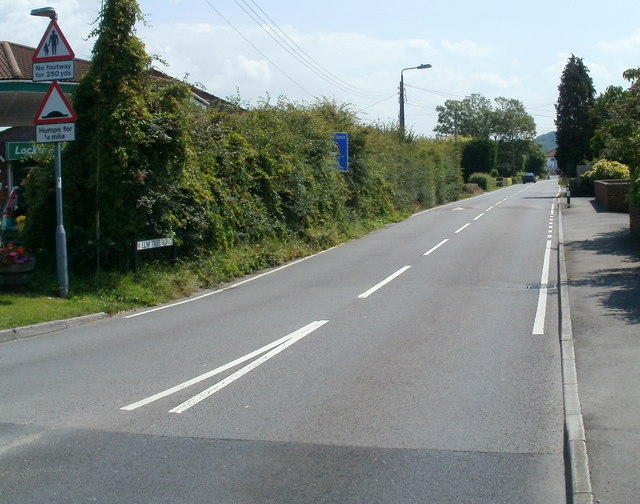
Image: © Jaggery Taken: 27 Jul 2011
Though Elm Tree Road is heading into the centre of Locking, the pavement on the right ends ahead, beyond which point there are no pavements for 250 yards. Mostly hidden by an untrimmed hedge, a rectangular blue sign shows Weight Limit 7.5 tonnes 1 mile ahead.
Images are licensed for reuse under creativecommons.org/licenses/by-sa/2.0
Image Location
Latitude
51.337428
Longitude
-2.922995