The Samuel Peto, Reservoir Street, Folkestone
Introduction
The photograph on this page of The Samuel Peto, Reservoir Street, Folkestone by pam fray as part of the Geograph project.
The Geograph project started in 2005 with the aim of publishing, organising and preserving representative images for every square kilometre of Great Britain, Ireland and the Isle of Man.

There are currently over 7.5m images from over 14,400 individuals and you can help contribute to the project by visiting https://www.geograph.org.uk
The Samuel Peto, Reservoir Street, Folkestone
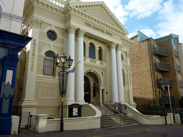
Image: © pam fray Taken: 13 Sep 2012
This was originally a Salem Baptist Chapel, built in 1873. It is a Grade II listed building and inside it retains the organ pipes, double pulpit, balconies, painted ceiling and chandeliers. It was converted into a public house in 2003. It is named after Sir Samuel Peto, a 19th century English entrepreneur, civil engineer, railway developer and Liberal MP.
Images are licensed for reuse under creativecommons.org/licenses/by-sa/2.0
Image Location
Latitude
51.080349
Longitude
1.18139