Former Burton Tailors building
Introduction
The photograph on this page of Former Burton Tailors building by Bill Harrison as part of the Geograph project.
The Geograph project started in 2005 with the aim of publishing, organising and preserving representative images for every square kilometre of Great Britain, Ireland and the Isle of Man.

There are currently over 7.5m images from over 14,400 individuals and you can help contribute to the project by visiting https://www.geograph.org.uk
Former Burton Tailors building
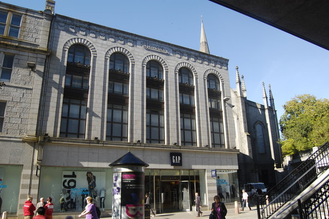
Image: © Bill Harrison Taken: 8 Sep 2012
The logo "Montague Burton the Tailor of Taste" at the top of the building seems to date from the 1930s: http://andrewsandpygott.wordpress.com/2011/01/31/dating-montague-burton-clothing/ . The ground floor is now occupied by a clothing shop more to modern tastes... Part of St Nicholas Kirk is visible to the right.
Images are licensed for reuse under creativecommons.org/licenses/by-sa/2.0
Image Location
Latitude
57.147278
Longitude
-2.09848