Windmill den in Skirth Road
Introduction
The photograph on this page of Windmill den in Skirth Road by Chris as part of the Geograph project.
The Geograph project started in 2005 with the aim of publishing, organising and preserving representative images for every square kilometre of Great Britain, Ireland and the Isle of Man.

There are currently over 7.5m images from over 14,400 individuals and you can help contribute to the project by visiting https://www.geograph.org.uk
Windmill den in Skirth Road
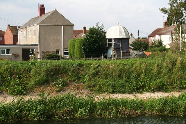
Image: © Chris Taken: 9 Sep 2012
Looking from the opposite bank of the Billinghay Skirth Drain, you can see what looks like the top of an old windmill in a back garden. It's been there for many years, but on closer inspection through the lens, I'm beginning to wonder whether if that's what it really is...it's very small!
Images are licensed for reuse under creativecommons.org/licenses/by-sa/2.0
Image Location
Latitude
53.081528
Longitude
-0.270119