Viewing platform for the Battle of Lewes 1264
Introduction
The photograph on this page of Viewing platform for the Battle of Lewes 1264 by Marathon as part of the Geograph project.
The Geograph project started in 2005 with the aim of publishing, organising and preserving representative images for every square kilometre of Great Britain, Ireland and the Isle of Man.

There are currently over 7.5m images from over 14,400 individuals and you can help contribute to the project by visiting https://www.geograph.org.uk
Viewing platform for the Battle of Lewes 1264
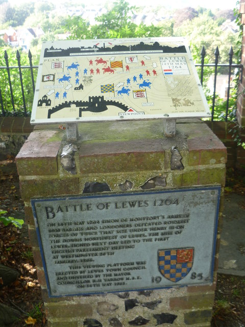
Image: © Marathon Taken: 6 Sep 2012
The information plaque here explains that on 14th May 1264 Simon de Montfort's army of 5,000 barons and Londoners defeated Royalist forces of twice that size under Henry III on the downs north-west of Lewes. The Mise of Lewes signed the next day led to the first English Parliament meeting at Westminster 20th January 1265. For the actual view see http://www.geograph.org.uk/photo/3120812 and see also http://www.geograph.org.uk/photo/3120904
Images are licensed for reuse under creativecommons.org/licenses/by-sa/2.0
Image Location
Latitude
50.873927
Longitude
0.007905