Rochdale:Maclure Road and St. John's RC Church
Introduction
The photograph on this page of Rochdale:Maclure Road and St. John's RC Church by Dr Neil Clifton as part of the Geograph project.
The Geograph project started in 2005 with the aim of publishing, organising and preserving representative images for every square kilometre of Great Britain, Ireland and the Isle of Man.

There are currently over 7.5m images from over 14,400 individuals and you can help contribute to the project by visiting https://www.geograph.org.uk
Rochdale:Maclure Road and St. John's RC Church
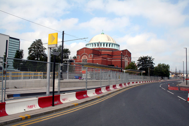
Image: © Dr Neil Clifton Taken: 8 Sep 2012
Showing that the Metrolink station at this point is virtually complete. Overhead has already been strung in position, and Metrolink will want to begin trial running between Oldham and Rochdale station as soon as they can. There is still talk of public service to here by the end of 2012, but it will be 2014 before the trams reach Rochdale Town Centre.
Images are licensed for reuse under creativecommons.org/licenses/by-sa/2.0
Image Location
Latitude
53.611113
Longitude
-2.154736