Ring o Bells
Introduction
The photograph on this page of Ring o Bells by Gerald England as part of the Geograph project.
The Geograph project started in 2005 with the aim of publishing, organising and preserving representative images for every square kilometre of Great Britain, Ireland and the Isle of Man.

There are currently over 7.5m images from over 14,400 individuals and you can help contribute to the project by visiting https://www.geograph.org.uk
Ring o Bells
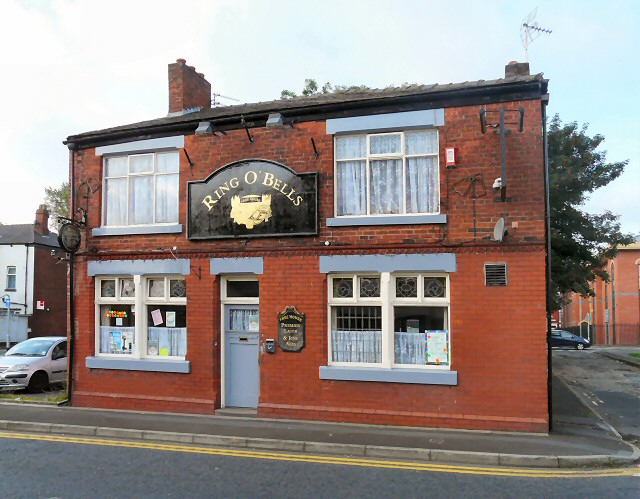
Image: © Gerald England Taken: 3 Sep 2012
Once surrounded by terraced house, by the 1980s it was surrounded by light industry. Now Margaret Street Image is part of the one-way system at the West End of Ashton between Katherine Street and Chester Square. The now somewhat isolated pub was originally a beerhouse owned by James Wood from 1863 to 1882. It became a Bents and Gartside's pub in 1939 and granted a full licence in 1953. It became a Bass pub in 1967 but is now a free house. Image Image
Images are licensed for reuse under creativecommons.org/licenses/by-sa/2.0
Image Location
Latitude
53.486049
Longitude
-2.105