Braunston Tunnel
Introduction
The photograph on this page of Braunston Tunnel by Stuart Logan as part of the Geograph project.
The Geograph project started in 2005 with the aim of publishing, organising and preserving representative images for every square kilometre of Great Britain, Ireland and the Isle of Man.

There are currently over 7.5m images from over 14,400 individuals and you can help contribute to the project by visiting https://www.geograph.org.uk
Braunston Tunnel
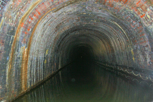
Image: © Stuart Logan Taken: 13 Aug 2012
The tunnel has no towpath and is 15 foot 7 inches wide by 12 foot 3 inches high. Behind this view is an 'S' bend caused by the primitive setting out procedures.
Images are licensed for reuse under creativecommons.org/licenses/by-sa/2.0
Image Location
Latitude
52.282748
Longitude
-1.170563