Former Royal Military Academy - SE18
Introduction
The photograph on this page of Former Royal Military Academy - SE18 by David Hallam-Jones as part of the Geograph project.
The Geograph project started in 2005 with the aim of publishing, organising and preserving representative images for every square kilometre of Great Britain, Ireland and the Isle of Man.

There are currently over 7.5m images from over 14,400 individuals and you can help contribute to the project by visiting https://www.geograph.org.uk
Former Royal Military Academy - SE18
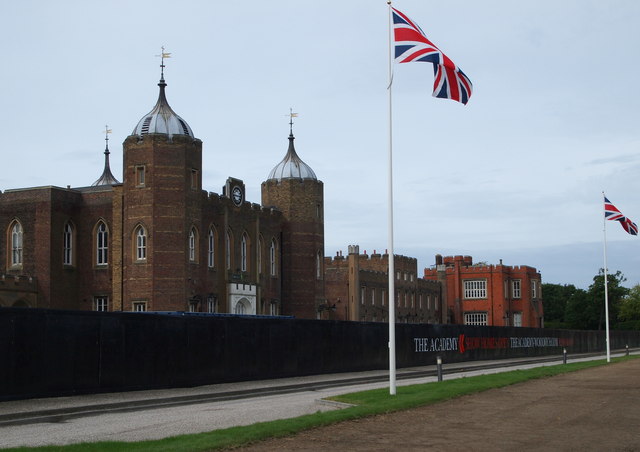
Image: © David Hallam-Jones Taken: 6 Aug 2012
The central building - i.e. the library building (c.1808) - with its leaded ogee domed octagonal towers was modelled on the White Tower of the Tower of London where the architect, Sir James Wyatt, worked in his role as Surveyor-General of the Ordnance. A private, gravelled road can also be seen passing in front of the security fencing from the East Lodge (on the left) to the West Lodge in the other direction, the latter emptying onto Academy Road (a.k.a. the South Circular or A205 road). "The Green", i.e. the bare area on the left has recently been prepared and seeded by Blackheath Cricket Club as a new cricket field, it being a protected "green space" on which building is not permitted.
Images are licensed for reuse under creativecommons.org/licenses/by-sa/2.0
Image Location
Latitude
51.476295
Longitude
0.059304