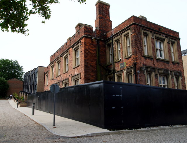
Former Military Academy - SE18
Introduction
The photograph on this page of Former Military Academy - SE18 by David Hallam-Jones as part of the Geograph project.
The Geograph project started in 2005 with the aim of publishing, organising and preserving representative images for every square kilometre of Great Britain, Ireland and the Isle of Man.
There are currently over 7.5m images from over 14,400 individuals and you can help contribute to the project by visiting https://www.geograph.org.uk

Image: © David Hallam-Jones Taken: 6 Aug 2012
An example of an approach to providing affordable housing under Section 106 of the Town and Country Planning Act 1990 can be found on the site of the former training establishment for gentlemen. In the distance a row of terraced houses can be seen - some of which fall within the category of 'social housing'. In the forefront of this picture is a boarded up former academy block waiting to be converted into private housing units. The road to the photographer's right - once an internal military barracks road - is now referred to as Ashmore Road and it connects Red Lion Lane with Academy Road (a.k.a. the South Circular Road or the A205), although security gates at either end of it mean that it is not a regular thoroughfare.

