Hill Rise
Introduction
The photograph on this page of Hill Rise by Simon Carey as part of the Geograph project.
The Geograph project started in 2005 with the aim of publishing, organising and preserving representative images for every square kilometre of Great Britain, Ireland and the Isle of Man.

There are currently over 7.5m images from over 14,400 individuals and you can help contribute to the project by visiting https://www.geograph.org.uk
Hill Rise
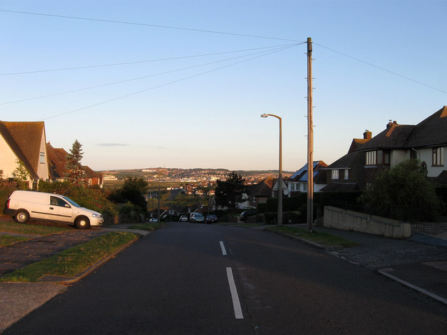
Image: © Simon Carey Taken: 26 Aug 2012
Built on Hawth Hill in the 1930s to provide the spine along with Image and Image for a projected new town based around Bishopstone. A few houses and a new station had been constructed by the time the Second World War bought proceedings to a halt. Post war shortages and the tougher 1947 Town Planning Act ended plans for the new town with development limited to infilling on this road and the completion of a small self contained estate on Rookery Hill in the early 1970s. The town of Newhaven can be seen in the distance.
Images are licensed for reuse under creativecommons.org/licenses/by-sa/2.0
Image Location
Latitude
50.782628
Longitude
0.085563