Chapel Lane, Hoghton
Introduction
The photograph on this page of Chapel Lane, Hoghton by K A as part of the Geograph project.
The Geograph project started in 2005 with the aim of publishing, organising and preserving representative images for every square kilometre of Great Britain, Ireland and the Isle of Man.

There are currently over 7.5m images from over 14,400 individuals and you can help contribute to the project by visiting https://www.geograph.org.uk
Chapel Lane, Hoghton
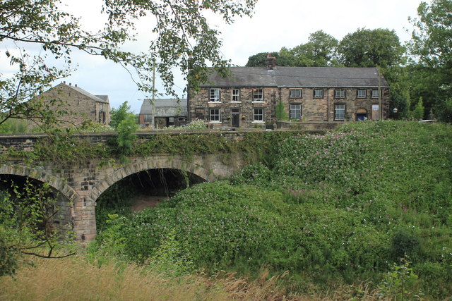
Image: © K A Taken: 28 Jul 2012
Looking across the cutting of the Blackburn and Preston Railway line to the three arch bridge that carries the lane over the railway, and to the now disused Wesleyan Chapel which was built in 1794.
Images are licensed for reuse under creativecommons.org/licenses/by-sa/2.0
Image Location


Leaflet Map data © OpenStreetMap
Latitude
53.736652
Longitude
-2.575578