Friars Walk
Introduction
The photograph on this page of Friars Walk by Simon Carey as part of the Geograph project.
The Geograph project started in 2005 with the aim of publishing, organising and preserving representative images for every square kilometre of Great Britain, Ireland and the Isle of Man.

There are currently over 7.5m images from over 14,400 individuals and you can help contribute to the project by visiting https://www.geograph.org.uk
Friars Walk
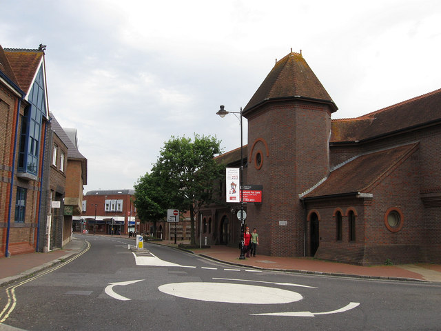
Image: © Simon Carey Taken: 19 Aug 2012
The B2193 which runs southwards to Southover. The road name is a corruption of Friars Wall which originally was a boundary of a friary run by the Greyfriars which occupied the area on the right between the roundabout and Lewes High Street. The friary was built in the 13th century and was demolished after the dissolution and replaced by a mansion known as The Friars. This survived until the 19th century when it too was demolished to make way for the original Lewes railway station that opened in 1846 as a terminus from Brighton. As the local railway network was extended the alignment of the original station became untenable and it was replaced in 1857 by the first of a number of layouts on the current station site. The old station became the main offices for the goods yard and remained in use until it too followed its predecessors and was demolished in 1968 and replaced by the current building which is home to the local magistrates court.
Images are licensed for reuse under creativecommons.org/licenses/by-sa/2.0
Image Location
Latitude
50.873635
Longitude
0.014431