Washbrook Farm, Aston-le-Walls equestrian centre: aerial
Introduction
The photograph on this page of Washbrook Farm, Aston-le-Walls equestrian centre: aerial by Chris as part of the Geograph project.
The Geograph project started in 2005 with the aim of publishing, organising and preserving representative images for every square kilometre of Great Britain, Ireland and the Isle of Man.

There are currently over 7.5m images from over 14,400 individuals and you can help contribute to the project by visiting https://www.geograph.org.uk
Washbrook Farm, Aston-le-Walls equestrian centre: aerial
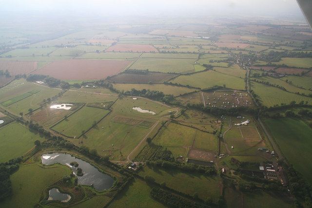
Image: © Chris Taken: 13 Aug 2010
See: http://aston-le-walls.co.uk/ Looking north-west. This is a centre specialising in horse trials and the training of three-day-event horses. This is a competition day: the horseboxes are parked in the field half way up on the right. The dressage arenas are opposite, extreme left. The village top right is Lower Boddington. The disused railway line across the bottom used to join up with the main line to Leamington Spa.
Images are licensed for reuse under creativecommons.org/licenses/by-sa/2.0
Image Location


Leaflet Map data © OpenStreetMap
Latitude
52.15674
Longitude
-1.286631