Woodhall Spa, Tower on the Moor: aerial 2012
Introduction
The photograph on this page of Woodhall Spa, Tower on the Moor: aerial 2012 by Chris as part of the Geograph project.
The Geograph project started in 2005 with the aim of publishing, organising and preserving representative images for every square kilometre of Great Britain, Ireland and the Isle of Man.

There are currently over 7.5m images from over 14,400 individuals and you can help contribute to the project by visiting https://www.geograph.org.uk
Woodhall Spa, Tower on the Moor: aerial 2012
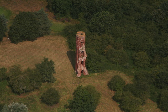
Image: © Chris Taken: 19 Aug 2012
There are theories that it was built as a lookout, for defence purposes, or for fun (like a folly), but the most convincing theory is that it is the remains of a hunting lodge - see https://www.heritagegateway.org.uk/Gateway/Results_Single.aspx?uid=MLI43570&resourceID=1006 The "Moor" is now a golf course. A good place to view the tower from the ground is from the footpath along the old railway track. See also Image
Images are licensed for reuse under creativecommons.org/licenses/by-sa/2.0
Image Location
Latitude
53.159095
Longitude
-0.19027